 Catalogo de metadatos del IGME
Contact for the resource
Research Group on Economic Geology of Mineral Resources (Gi-Gecomin).
Type of resources
Available actions
Keywords
Contact for the resource
Provided by
status
Service types
From
1
-
1
/
1
-
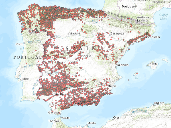
The service consists of two layers of dots symbolising the position of mineral occurrences for the entire national territory. Depending on the scale of visualisation, two layers of information have been created. Indications I: Only the location of the points is represented. Visible from scales smaller than 1:200.000. Indications II: The points are represented with a symbolisation according to different attributes. Visible from scales larger than 1:200,000. The reference systems offered by this service are:CRS:84, EPSG:4326, EPSG:4258, EPSG:4230, EPSG:23028, EPSG:23029, EPSG:23030, EPSG:23031, EPSG:25828, EPSG:25829, EPSG:25830, EPSG:25831